

The Roy's Peak Track was the second item on my Wanaka bucket list. I had planned to to do it next week when I was back in the area but the track was to be closed tomorrow for the lambing season...luckily we checked. This was said to be a tough walk with no rest points. Tyson would have to carry Alba all the way in the pack. Clara wasn't keen on a massive day but up we went!
To get to the Roy's Peak Track from Wanaka, drive in western direction on the Wanaka – Mount Aspiring Road towards Glendhu Bay. After driving for approximately 6km, look for the Roy's Peak Track parking lot on the left side of the road where the track starts. There is a sign and an information panel at the beginning of the Track. As i said, the track is closed in the spring for the lambing season and the dates change as we found out!
The summit of Mount Roy towers 1,578 meters (5,177 ft) above sea level. You can get 360-degree views of most of Lake Wanaka, Mount Aspiring, the Matukituki Valley, Wanaka, and even see as far as Hawkdun Range in Central Otago.
This walk was every bit as tough as people said it was. Maybe it was the snow, maybe it was the heavy camera gear but it hurt...especially on the way down.
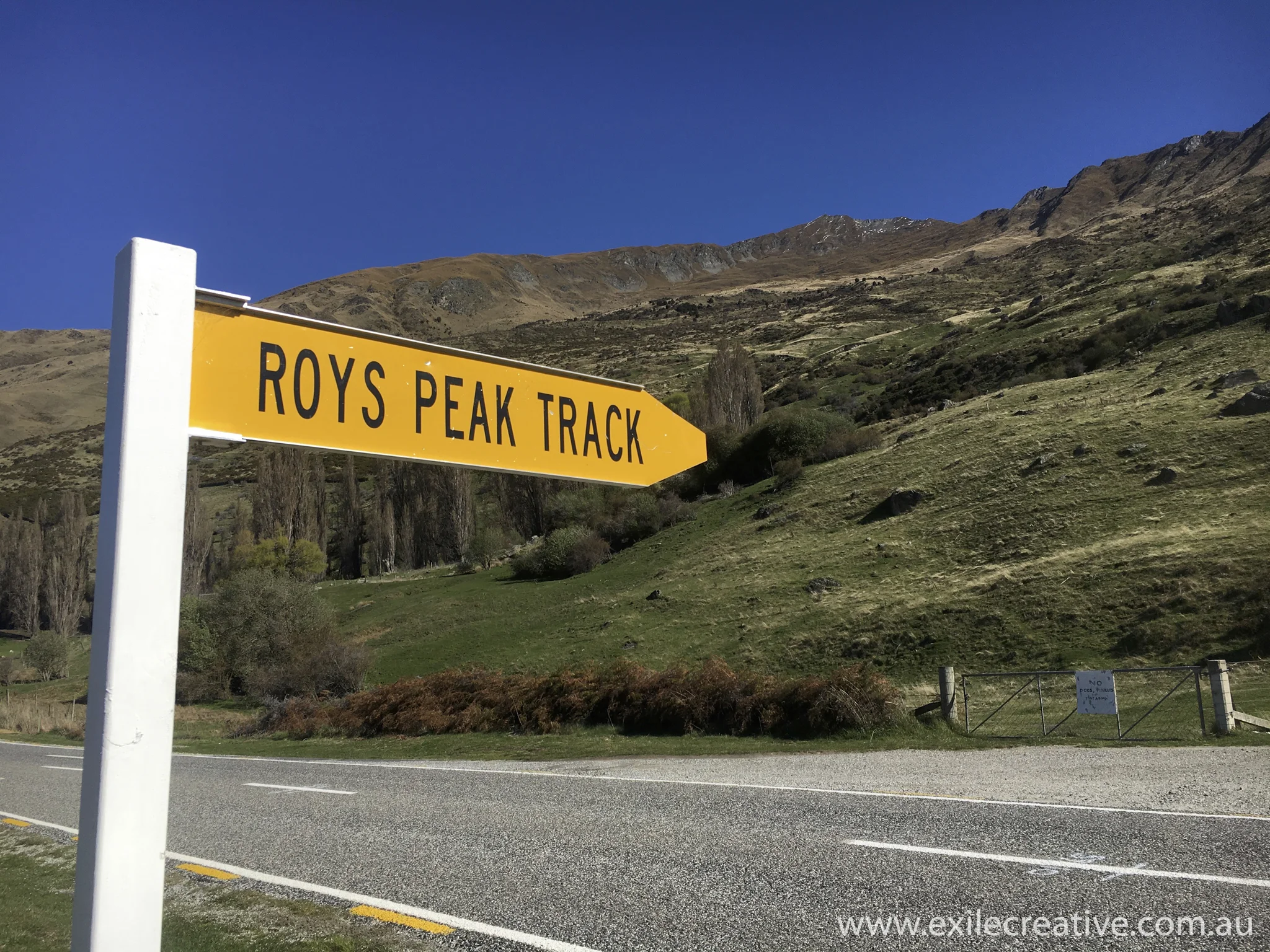
What to look for when looking for this track. Mount Roy is the peak in the background and it's a lot higher than it looks here!
iPhone 6S

Just a bit of info.
iPhone 6S

Clara and Tyson with Alba. Alba had been in the pack for about 4hrs at this point and still smiling! What a trooper!
Canon 5Dmiii, 100-400L II IS @ 100mm, ISO800, f/7.1, 1/250s

Pushing to the summit.
Canon 5Dmiii, 24-105L IS @ 35mm, ISO200, f/8, 1/160s

View from Mount Roy summit.
Canon 5Dmiii, 16-35L III @ 16mm, ISO100, f/8, 1/80s
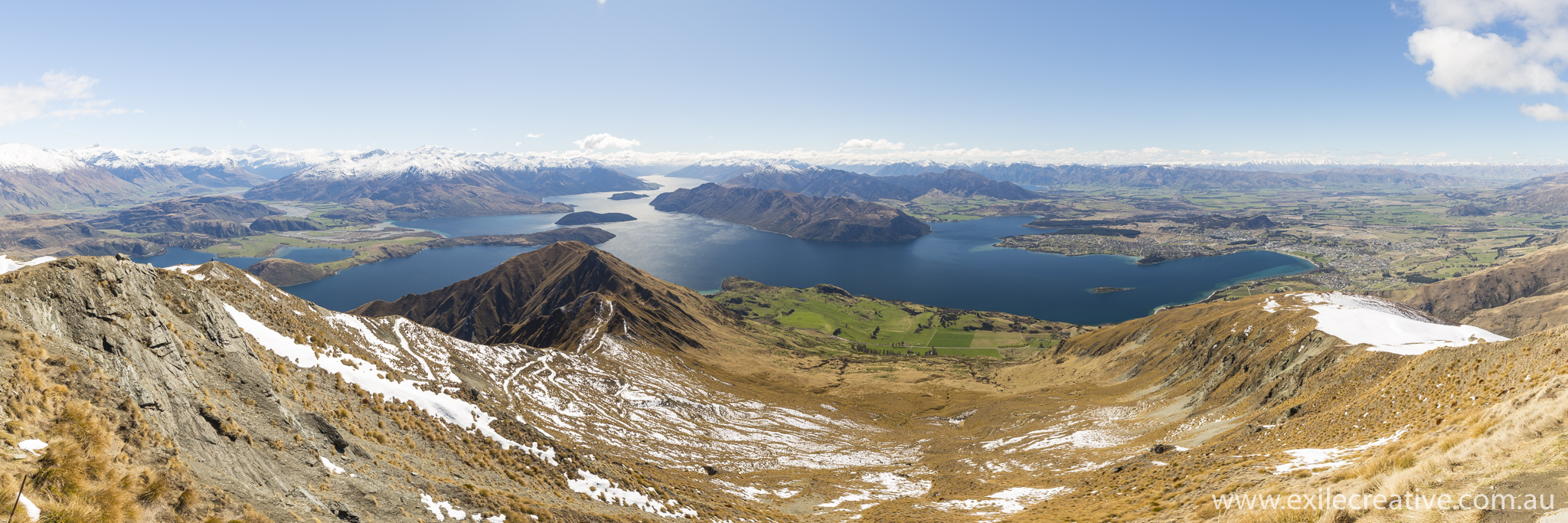
Lake Wanaka
Canon 5Dmiii, 16-35L III @ 16mm, ISO100, f/8, 1/125s Stitched pano